Trans-Labrador Highway

Central & Western Labrador

July 2000

(Page 1 of 5)


The 
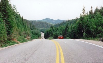
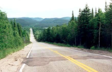
Trans-Labrador Highway (along with Quebec Hwy 389) travels through one of the most remote areas of Eastern Canada.  What affected me the most on the journey was the staggering emptiness of the land.  Empty of human influences, that is.  Very full of Nature.  The silence hit me whenever I stopped and turned off the car's engine.  Mile after mile of spruce forest and bogs, creeks and rivers and lakes.  A big empty sky.  A lonely road.  Driving this road feels like an adventure.

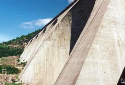
The road to Labrador starts at Baie Comeau, which is located on the north shore of the St. Lawrence River, 440 km east of Quebec City (1216 km east of Toronto).  The scenery east of Quebec City is spectacular up to when you cross the Saguenay River at Tadoussac, on a free ferry.  From that point east to Baie Comeau, it is much flatter.

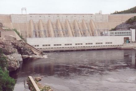
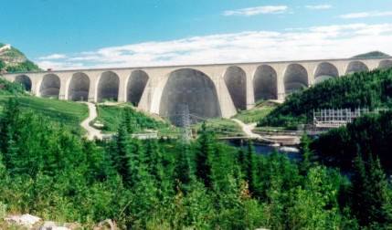
The road from Baie Comeau to Labrador consists of two parts, politically speaking:  Hwy 389 through Quebec to the Labrador border (570 km), and the Trans-Labrador Highway (Hwy 500), which runs from the border to Goose Bay, Labrador (560 km), for a total of 1130 km.

From a practical point of view, the highway consists of two parts as well: paved and gravel.  And after traveling the entire route from Baie Comeau to Goose Bay and back on about 1600km of gravel road, you will never again take paved roads for granted!!


(Click here for Travel Information)


Hwy 389 in Quebec

 
km0

Baie Comeau is where this road begins.  This is the last town until Labrador City (585km from here), so stock up on what you need.

From here to Manic 5 (212km) the road is paved, but it is twisty, narrow, and very hilly, with no real shoulder.  No gas until the Manic 5 dam, 212km to the north.
There are lots of logging trucks along this section, and they really move when they are driving north empty.  They probably appreciate it if you find a good place to pull over and allow them to pass.  You'll also have a less stressful drive without them up your rearend.

   
km24
Manic 2 dam and generating station The Manic 2 dam and hydro-electric generating station is located here.  You can take a tour, but I suggest that you save your tour time for Manic 5 and/or Churchill Falls.
   
  Here's a couple of pictures along the way, to give you an idea of what the road and scenery are like:
km78
km78  
   
km130
Km130  
   
km212
Daniel Johnson dam & Manic 5

Here you reach the visually striking Daniel Johnson dam and the Manic 5 generating station. 

It is the largest dam of its type in the world.  You can take a tour of the dam and hydro generating facility (although I didn't).


Daniel Johnson dam This dam is huge - for scale note the relative size of the power line poles in the lower left corner of the picture.
 

There is gas available here; the last for 104km.

Also, the pavement ends here.  You will be on gravel road for the next 916km to Goose Bay, except for the 90km stretch from Gagnon to Fire Lake, the 20km between Fermont and Labrador City, and the 1km through Churchill Falls.


The material on this page is copyright © by the original author/artist/photographer. This website is created, maintained & copyright © by Walter Muma
Please respect this copyright and ask permission before using or saving any of the content of this page for any purpose

Thank you for visiting!